![]()
Mohawk College partnered with Ontario Power Generation to explore how RPAS-mounted LiDAR can help monitor reconstruction and remediation projects such as plant overgrowth in dam restoration and renewal projects.

Funder: Ontario Power Generation
Research Area: Unmanned & Remote Sensing
Research Team: Richard Borger, Matthew Shelley, James Kretz
Future Ready Challenge
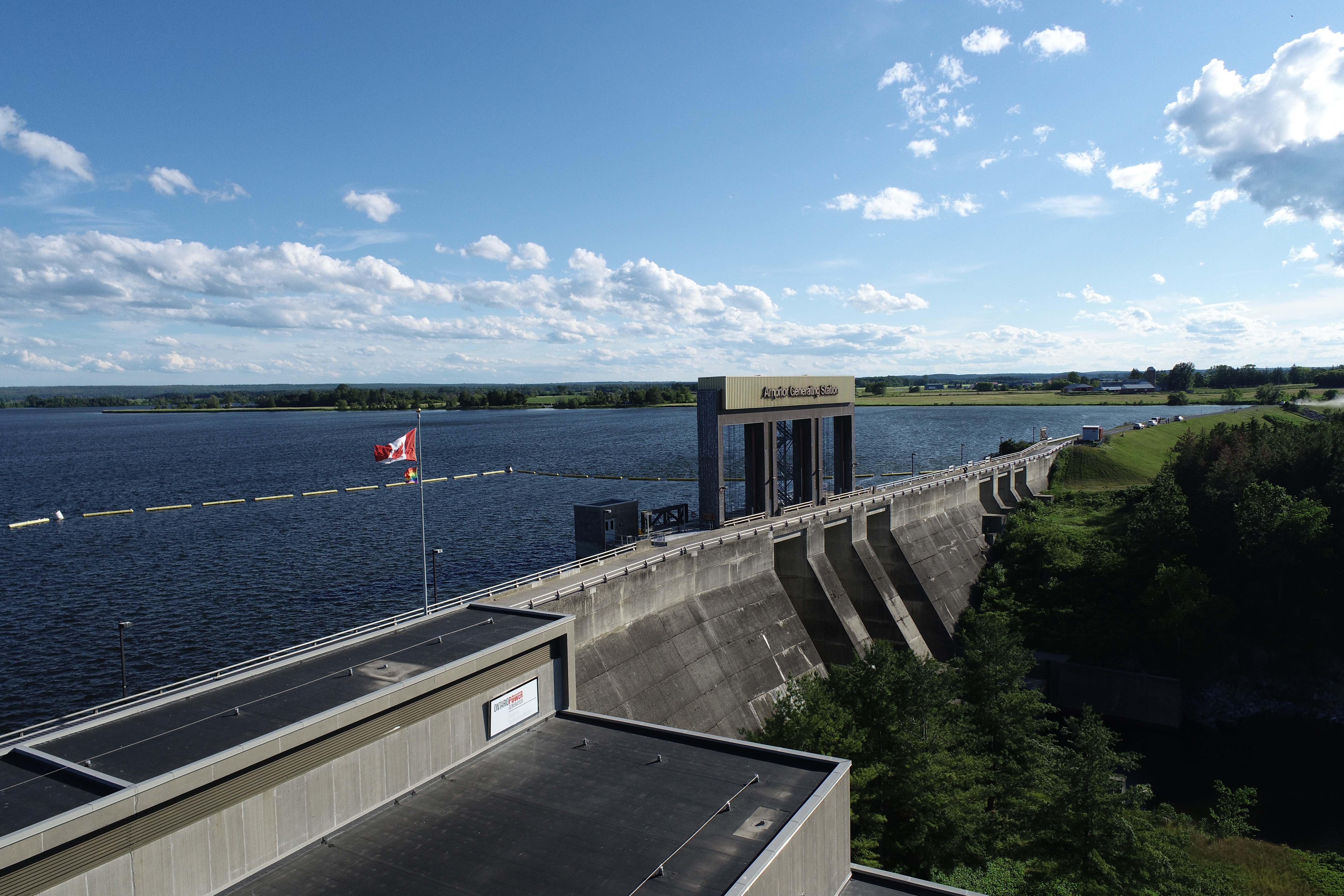
Large infrastructures such as dams, bridges, turbine blades require routine inspection. It can be extremely challenging to maintain an accurate visual representation of a large infrastructure, which is often required in preparation for maintenance and construction. Traditional inspections require workers to enter challenging and potentially dangerous areas, but is it possible to collect the same data more quickly and with less risk?
Remotely piloted aircraft systems (RPAS) have the potential to change the way organizations collect data for renovations, repairs, and rebuilds. This is most evident at hydroelectric dam facilities, whose geographic locations make it difficult to complete visual inspections quickly and accurately.
R & D Collaboration
Ontario Power Generation (OPG) is a Crown Corporation responsible for approximately half of the electricity generated in Ontario. The Inspection and Reactor Innovation (IRI) division is responsible for inspections and repairs at OPG’s numerous hydroelectric facilities. Faced with a planned renewal project at the Waba Dam near Ottawa, Ontario, the IRI division asked the Unmanned and Remote Sensing Innovation Centre (URSIC) team at Mohawk to assist in creating a 3D model of the existing structures.
The Waba Dam is an earthworks dam, meaning it is essential to regularly examine and maintain the walls of the dam. Earthworks settle over time, so they require ongoing inspections and renewal to preserve the integrity of the dam. The URSIC team was tasked with scanning the area using RPAS-mounted LiDAR and using that data to create a high-resolution 3D model of the dam and surrounding area.
Innovative Results
Mohawk’s URSIC team used a DJI M600 Pro equipped with the Phoenix SCOUT-32 LiDAR system to accurately scan the Waba Dam and surrounding area, allowing the OPG team to properly assess the existing earthworks prior to the planned renewal. After the remediation was completed, the URSIC team returned to scan the location and provide an updated high-resolution 3D model of the dam.
URSIC’s expertise with LiDAR and RPAS allowed them to accurately and thoroughly scan the dam and surrounding area. The URSIC team was also instrumental in the creation and interpretation of the LiDAR point cloud and assisted in creating the 3D models. Using this data, the OPG IRI team was able to execute the needed reinforcements and updates on the Waba Dam.
“Mohawk College, through their collaboration with Ontario Power Generation, has proven that LiDAR technology has real world applications in restoration and rehabilitation projects,” says Tim Trebilcock, Senior Information Systems Specialist and CIO of Digital Innovation & Strategy at OPG. “The use of this technology has widespread applications in reducing the risk for workers, saving time and money on large scale projects.”
Watch this video for a comparison between colourized LiDAR data and standard video of the Arnprior Generating Station.
